Paper accepted at IEEE Transactions on Geoscience and Remote Sensing
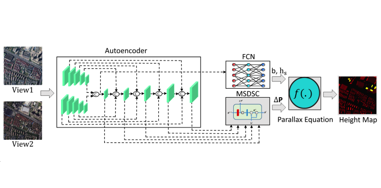
Our paper titled “Stereollax Net: Stereo Parallax Based Deep Learning Network For Building Height Estimation” accepted at IEEE Transactions on Geoscience and Remote Sensing. This work was an outcome of PhD Thesis work by Sana Jabbar More info: Click here