VillageFinder: Segmentation of Nucleated Villages in Satellite Imagery

VillageFinder: Segmentation of Nucleated Villages in Satellite Imagery

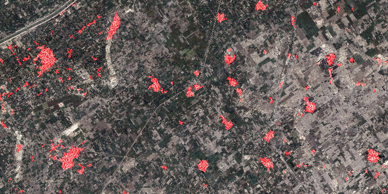
Kashif Murtaza, Sohaib Khan, Nasir Rajpoot 50 sq km image of rural area, with village outpus marked in red. 2.3% false positives at 0.01% false negatives [high res version 30MB JPG] Abstract Geo-spatial data on village locations, their size, population and other parameters is scarcely available to decision makers in many developing countries. In this…

BMVC 2009 – VillageFinder: Segmentation of Nucleated Villages in Satellite Imagery
|

BMVC 2009 – VillageFinder: Segmentation of Nucleated Villages in Satellite Imagery

Kashif Murtaza, Sohaib Khan, Nasir Rajpoot British Machine Vision Conference (BMVC), September 2009 Abstract Geo-spatial data on village locations, their size, population and other parameters is scarcely available to decision makers in many developing countries. In this paper, we demonstrate an automatic “crawler” which can segment nucleated villages from satellite imagery freely available in public…